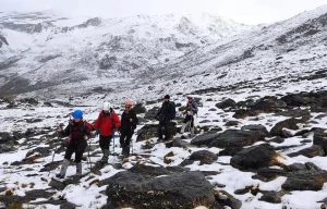
Mulhacén, at 3,479 metres (11,414 ft) — the official height set by Spain’s National Geographic Institute (IGN) — is not just the highest peak in the Iberian Peninsula: it is the highest mountain in Western Europe outside the Alps, and one of those ascents that changes whoever takes it on. Physical effort, mental grit and an intimate encounter with a landscape declared a UNESCO Biosphere Reserve.
This guide is written by the certified mountain guides at Sendalpina — more than 10 years exploring Sierra Nevada from Capileira — and gives you everything you need to plan your climb: routes, refuges, the best season, gear, training and answers to the most common questions. If you’d rather do it guided, you can join us for the ascent in a single day or over two days with an overnight stay in a refuge.
How high is Mulhacén and where is it?
Mulhacén stands 3,479 metres (11,414 ft) above sea level (official IGN height) and is the highest mountain in mainland Spain and the Iberian Peninsula. It sits in the province of Granada (Andalusia), in the heart of the Sierra Nevada massif, within the Sierra Nevada National Park. Its coordinates are 37° 03′ N · 3° 18′ W.
The closest villages are Capileira (south face, the most popular starting point) and Trevélez (the highest village in Spain). For the northern approach, access is via the Hoya de la Mora, above the city of Granada.
- Altitude: 3,479 m / 11,414 ft
- Mountain range: Sierra Nevada (Penibaetic System)
- Province: Granada
- National Park: Sierra Nevada
- Most common start point: Hoya del Portillo (Capileira)
- Nearest staffed refuge: Poqueira Refuge (2,500 m)
Why climb Mulhacén? A challenge worth the reward
Climbing Mulhacén is far more than bagging a summit: it’s an immersion in 2 billion years of geological history and an adventure that tests your own limits. Here’s why this ascent has become a symbol of Spanish mountaineering:
- Personal achievement: reaching 3,479 metres is a challenge that shows what you’re capable of, leaving a deep and lasting sense of satisfaction.
- Unique panoramic views: on clear days the horizon stretches from the Mediterranean to the Moroccan Atlas, symbolically linking two continents.
- Endemic nature: the climb crosses unique ecosystems where flora and fauna have adapted to extreme conditions (more than 30% of the peninsula’s flora concentrated in just 0.4% of its territory).
- Accessible with preparation: unlike more technical peaks, the popular routes mean that, with the right preparation and a guide, any mountain lover can complete the ascent.
How to get to Mulhacén and the National Park shuttle bus (essential in summer)
The most common logistical question before climbing Mulhacén is how you reach the start of the classic route. In summer, the forest track that climbs from the Alpujarra to the high country is closed to private vehicles: the only authorised transport is the National Park shuttle bus run by the SIAC (High Peaks Interpretation Service).
- Where you catch it: in Capileira, at the SIAC information point. That’s where you park the car and buy your ticket.
- Where it drops you: at the Alto del Chorrillo (approx. 2,700 m), where the trail to the summit begins. This cuts the ascent to around 800 m of elevation gain.
- Booking: places are limited and sell out in July and August. It’s best to book several days (ideally weeks) ahead. Prices and timetables change each season, so always confirm the current fares and departures with the SIAC before your visit.
- Parking: you park in Capileira (Hoya del Portillo). In peak season it fills up early, so set off first thing.
Note: the SIAC bus only runs in season (roughly late spring to autumn, depending on snow). Outside that window, the approach is done on foot — or on skis/snowshoes — from lower ground, which makes for a considerably longer day.
Routes to climb Mulhacén
One of the keys to success is choosing the route that best matches your fitness and experience. There are four main ways to reach the summit, each with its own character. Distances, elevation and times below are approximate and taken from publicly available route data; conditions on the ground vary.
1. Classic route from Capileira (Hoya del Portillo) — South face
The most popular and accessible route, especially in summer. Locals in the Alpujarra call Mulhacén «El Cerro» (the hill) because of its gentle southern slopes.
- Distance: approx. 25 km (round trip)
- Elevation gain: approx. +1,330 m (from Hoya del Portillo at 2,150 m)
- Duration: 7–9 hours in a day, or 2 days with an overnight stay
- Difficulty: moderate (hiking)
- SIAC service: in summer, the National Park minibus reaches the Alto del Chorrillo (2,700 m), cutting the gain to around 800 m
- Overnight: option to sleep at the Poqueira Refuge (2,500 m)
The route step by step (from the Alto del Chorrillo): the bus drops you at the Alto del Chorrillo (approx. 2,700 m) and a wide, well-marked path climbs gently up the Loma del Mulhacén (Mulhacén ridge). The first landmark is Mulhacén II (the «false summit»), a foretop from which the main peak is already in view. After a short dip you tackle the steepest stretch — locally nicknamed the «cuesta del respeto» (respect slope) — up to the summit (3,479 m), where you’ll find the trig point and the remains of old stone huts. Wind on the top is often fierce; the small stone walls make good shelter. The descent follows the same line; mind your knees, and watch the clock so you don’t miss the last bus.
2. Route from Hoya de la Mora — North face
A wilder approach with constant views of the central «three-thousanders» and glacial-cirque scenery.
- Distance: approx. 28–30 km (round trip)
- Elevation gain: approx. +1,500 m
- Duration: 8–9 hours (1 day)
- Difficulty: moderate to high
- Landscape: glacial valleys, the striking Corral del Veleta and the Laguna de la Caldera
- Recommended combination: easily linked with the ascent of Veleta (3,394 m)
3. Route from Trevélez — The quieter alternative
The choice for those who want to avoid the crowds and soak up the most authentic Alpujarra.
- Distance: approx. 23 km (round trip)
- Elevation gain: approx. +1,600 m
- Duration: 9–10 hours (1 day), or 2 days recommended
- Difficulty: moderate to high
- Highlight: Trevélez (1,476 m), the highest village in Spain, famous for its cured Serrano ham
- Best done: over two days with a bivouac at the Siete Lagunas (Seven Lakes)

4. North face — Winter mountaineering
For experienced alpinists, the north face offers snow and ice routes of great technical beauty. Around 550 metres of climbing at average angles of 50°, it requires alpine experience, two ice axes, technical crampons and a helmet.
Classic lines: Canuto Central (AD−) and Gran Diagonal (D).
Quick route comparison
If you’re not sure which to pick, this table sums up the four main routes so you can decide by level and time available (figures approximate):
| Route | Distance | Elevation | Duration | Difficulty | Ideal for |
|---|---|---|---|---|---|
| Hoya del Portillo (south) | ~25 km | +1,330 m | 7–9 h | Moderate | First-timers / summer |
| Hoya de la Mora (north) | ~28–30 km | +1,500 m | 8–9 h | Moderate–high | Combining with Veleta |
| Trevélez | ~23 km | +1,600 m | 9–10 h | Moderate–high | 2-day adventure |
| North face (alpine) | ≈550 m vertical | +550 m | Variable | AD–D (technical) | Experienced alpinists |
Other routes and traverses
Beyond the four main routes, there are quieter alternatives:
- Route from the Capileira power station
- South Ridge: more direct but demanding
- Traverse from Güéjar Sierra along the Vereda de la Estrella: a long, spectacular option, two days minimum
Not sure which route to choose? Our guides will advise you based on your level, fitness and preferences. Message us on WhatsApp and we’ll answer your questions with no obligation.
Mulhacén and Veleta: can you climb both together?
Yes. The Mulhacén–Veleta traverse is one of the most rewarding options for those already fit who want to make the most of the day: it links Sierra Nevada’s two most iconic three-thousanders in a single outing.
Veleta (3,394 m), the peninsula’s third-highest summit, rises just 4 km west of Mulhacén and connects to it via a panoramic ridge passing the Laguna de la Caldera and the Collado del Ciervo. It’s a long day (10–12 hours) and physically demanding, but technically straightforward in summer.
For those wanting to go even further, there’s the legendary Integral of the 3000s: one of the most complete alpine routes in Spain, linking every three-thousander in the massif over several days.

A natural treasure at every step: geology, biodiversity and history
The climb to Mulhacén is a fascinating journey through the history of the Earth, Mediterranean biodiversity and the memory of the last Nasrid kingdom.
Geology of Sierra Nevada: the Betic massif
Mulhacén is part of the Betic Cordillera, formed by the collision of the African and Eurasian plates. The core of the range is the Nevado-Filábride Complex, split into two units:
- Veleta Unit (lower): low-grade pre-Alpine metamorphism.
- Mulhacén Unit (upper): the one that gives the summit its name, with high-pressure metamorphic rocks (mica schists, quartzites and marbles).
Glacial traces: today’s relief is a fossil landscape shaped by the Quaternary glaciations. During the climb you’ll see glacial cirques (Siete Lagunas), moraines and lakes of glacial origin such as the Laguna de la Caldera. A unique phenomenon is the presence of fossil glacial ice in the Corral del Veleta, a relic of the Little Ice Age.
Biodiversity: 2,100 species in 0.4% of Spain
Sierra Nevada is the most important centre of plant diversity in the western Mediterranean. During the climb you cross two bioclimatic belts:
- Oromediterranean belt (1,800–2,800 m): Scots pine woods, creeping junipers and blue broom.
- Cryoromediterranean belt (above 2,800 m): alpine grasslands with endemics such as the Snow Star (Plantago nivalis), the Royal Chamomile (Artemisia granatensis) and the Sierra Nevada Violet.
Emblematic fauna: Spanish ibex (the highest density in Europe), golden eagle, alpine accentor (the bird that reaches the greatest altitudes in the peninsula) and Baetica ustulata, a wingless endemic cricket adapted to extreme cold.
History and legend: the legacy of Muley Hacén
The peak’s name comes from Sultan Muley Hacén (Abu-l-Hasan ‘Ali), penultimate Nasrid king of Granada (1464–1485). Legend has it that, once dethroned, he asked to be buried at the highest point of his lands, where eternal cold would keep his memory.
In 1879, General Ibáñez e Ibáñez de Ibero carried out here the geodetic link between Europe and Africa — an operation so significant that Queen María Cristina granted him the title of Marquis of Mulhacén. The remains of the stone huts are still visible near the trig point.

Mountain refuges: where to sleep near Mulhacén
For those extending the adventure to two days, Sierra Nevada has strategically placed refuges:
Poqueira Refuge (2,500 m)
- Type: staffed refuge with full services.
- Services: accommodation in shared rooms, meals (dinner and breakfast), showers (usually cold) and equipment rental.
- Booking: essential in advance, especially in high season (June–September).
- Location: about 3–4 hours’ walk from Hoya del Portillo. An ideal base for the summit the next morning.
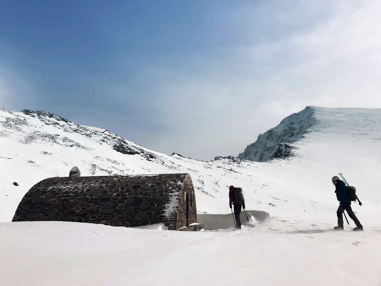
Caldera Bivouac Refuge (over 3,000 m)
- Type: free bivouac shelter (unstaffed).
- Set-up: wooden bunks, no services. First come, first served.
- Advice: bring all your gear and food. Set beside the Laguna de la Caldera, in one of the most spectacular spots in the massif.
Villavientos Refuge
Another bivouac-style shelter, in a strategic spot for various ascents in the high country.
Important note: wild camping is prohibited in the National Park. Bivouacking is allowed under strict conditions: prior notification, no camping within 50 m of lakes or high pastures, and restrictions in wooded areas (1 June – 15 October) due to fire risk.

Want to climb Mulhacén with a guide?
This page is an informational guide to help you plan the climb on your own. If what you want is to book the ascent with a UIMLA-certified guide, at Sendalpina we offer two formats to suit your time and fitness:
- 🥾 Climb Mulhacén in 1 day from Hoya del Portillo: the fastest option, ideal if you’re short on time and in good shape.
- 🏔️ Climb Mulhacén in 2 days with an overnight at the Poqueira Refuge: a more relaxed ascent, better acclimatisation and the full experience of sleeping at 2,500 metres.
Not sure which suits you best? Message us on WhatsApp and we’ll advise you with no obligation.
Tips for a safe ascent
Safety on Mulhacén comes down to preparation. These are the points we stress most as guides:
Best time to climb Mulhacén
- Summer and autumn (June–October): stable conditions and pleasant temperatures. Ideal for beginners and most walkers.
- Winter and spring (November–May): require experience, technical gear (crampons, ice axe) and caution around snow and avalanches.
No water sources on the route
A safety point that surprises many: there are no drinkable water sources along the classic route. You have to carry all your water from the start: at least 2 litres per person, and up to 3 on hot days. Water from streams and lakes is not safe to drink untreated.
Patchy mobile coverage
Mobile-phone coverage is intermittent for much of the route; there’s usually signal at the summit, but it’s not guaranteed. Don’t rely on coverage for your safety: carry the track downloaded offline, tell someone your route and expected timing, and consider a GPS device.
Always check the weather forecast
Weather in the high mountains changes abruptly. Check AEMET and the National Park’s specific high-mountain forecasts before setting off. A summit storm can be lethal even in July.
Essential equipment
- Layered clothing: breathable base, thermal mid-layer, waterproof and windproof outer.
- Footwear: mountain boots with good grip and high ankle support.
- Sun protection: category-4 sunglasses, SPF 50+ cream, hat and gloves (even in summer).
- Emergency kit: at least 2 litres of water, energy snacks, map or GPS, head torch and basic first-aid kit.
- In winter: add technical crampons, ice axe, helmet, gaiters and specific clothing.

Hydration and nutrition
Drink water before, during and after the climb. The high mountains dehydrate you fast through low humidity and intense sun. Carry at least 2 litres and eat something light every hour.
Acclimatisation
If you’re not used to altitude, plan acclimatisation climbs beforehand — for example, an ascent of Veleta the day before — and progress gradually to avoid altitude sickness.
The value of a professional guide
A certified mountain guide brings:
- Detailed knowledge of the routes and the changing conditions.
- Technical advice on gear and progression.
- Risk prevention and help if something goes wrong.
- Interpretation of the geological, biological and cultural heritage.
- Greater safety and peace of mind, especially on your first three-thousander.
How to train physically for Mulhacén
Climbing Mulhacén takes a reasonable level of fitness. These are the pillars of a basic plan:
Cardiovascular endurance
Walking, running, swimming or cycling, 3–4 sessions a week of 45–60 minutes for the 6–8 weeks before the climb. The goal is to handle 8–10 continuous hours of moderate activity.
Leg and core strength
Squats, lunges, calf raises and core work. 2 sessions a week are enough. Your legs don’t just climb — they also brake on the descent, where most injuries happen.
Progressive hiking
Walk on terrain with progressive elevation gain, gradually increasing duration (from 3 to 8 hours) and practising with a loaded pack (5–7 kg). If you can do an outing with 1,000 m of gain without exhausting yourself, you’re ready.
Specific winter training (optional)
If you plan a winter ascent, practise using crampons and an ice axe, and consider taking a mountaineering skills and avalanche-awareness course.
Need a tailored plan? Get in touch and we’ll design preparation to fit your date and level.

Can you climb Mulhacén with children?
A very common question among families. The answer is yes, with caveats. The south route from the Alto del Chorrillo can be viable for children aged 10–12 and up who are used to walking for several hours in the mountains and have good stamina. Keys to making it work:
- Make sure the decision and the motivation are theirs: without the will, the day is hard for everyone.
- Watch closely for their reaction to altitude (children are more sensitive): at the first sign of headache, dizziness or marked fatigue, the only answer is to descend.
- For a first high-mountain experience, better to start with shorter, lower routes to see how they respond.
The Alpujarra: a culture of water and stone
Mulhacén can’t be understood without its southern flank, the Alpujarra, where the architecture seems to grow from the rock itself:
- Careo irrigation channels: a system of Andalusi-origin channels that gather snowmelt and infiltrate it into the slopes to recharge aquifers. Recognised by UNESCO.
- Tinaos: covered passageways that shelter from the snow.
- Terraos: flat roofs waterproofed with launa, a local magnesium-rich clay.
- Conical chimneys: a visual icon of the region.
Villages like Capileira, Bubión and Pampaneira make up the Poqueira Gorge, one of the most photogenic corners of Andalusia and the natural starting point of the classic route up Mulhacén.
Ready to conquer the roof of the peninsula?
Climbing Mulhacén is far more than reaching the top: it’s an adventure that confronts you with your own limits and rewards you with views and experiences that stay with you forever. It’s an encounter with alpine geology, endemic biodiversity and Nasrid history.
With the right preparation and the company of Sendalpina’s UIMLA-certified guides, you can turn this challenge into a safe, thrilling and enriching experience. We’ve been climbing to the summit from Capileira for more than 10 years, and every ascent is still unique.
📱 Message us on WhatsApp and let’s plan your climb with no obligation.
📞 Phone: +34 645 841 890 | ✉️ Email: info@sendalpina.com
📍 Capileira (Granada), at the foot of Mulhacén.
Frequently asked questions about climbing Mulhacén
How high is Mulhacén?
Mulhacén is 3,479 metres (11,414 ft) according to the official height from Spain’s National Geographic Institute (IGN). It’s the highest mountain in the Iberian Peninsula and mainland Spain, and the highest in Western Europe outside the Alps.
Where is Mulhacén?
Mulhacén is in Sierra Nevada, in the province of Granada (Andalusia, Spain), within the Sierra Nevada National Park. Its coordinates are 37° 03′ N · 3° 18′ W. The usual accesses are from Capileira (south) and Hoya de la Mora (north).
When is the best time to climb Mulhacén?
The ideal season is from late spring to early autumn (June to October), when the weather is favourable and snow has cleared from the most-used routes. Winter ascents are also possible with technical gear (crampons, ice axe) and refuge overnights, but demand more experience.
How long does it take to climb Mulhacén?
It depends on the route and your fitness. The most accessible route from Hoya del Portillo usually takes 7 to 9 hours in total (round trip), roughly 4–5 hours up and 3–4 down. From Trevélez it’s 9–10 hours, and there’s the option of doing it over two days with a refuge overnight.
Is it hard to climb Mulhacén?
Climbing Mulhacén is achievable with good fitness, but it’s no stroll. The classic route from Hoya del Portillo has no technical difficulties: it’s high-mountain hiking with significant elevation gain. Alternatives like the north face or the winter north face do require experience and specific equipment.
What equipment do I need to climb Mulhacén?
The essentials in summer: mountain boots, layered clothing (thermal, fleece, waterproof and windproof), a pack with at least 2 litres of water, energy snacks, SPF 50+ sunscreen, category-4 sunglasses, a hat, a head torch and a first-aid kit. In winter, add technical crampons, an ice axe, a helmet, gaiters and extra warm clothing.
How do I catch the SIAC shuttle bus to climb Mulhacén?
In summer the high track is closed to private vehicles and the easy way up is the National Park’s SIAC shuttle bus. You catch it in Capileira (where you park and buy the ticket) and it drops you at the Alto del Chorrillo (approx. 2,700 m). Places are limited, so book ahead in high season. Prices and timetables change each season, so confirm the current fares with the SIAC.
Is there water on the Mulhacén route?
No, there are no drinkable water sources along the classic route. You must carry all your water from the start: at least 2 litres per person, and up to 3 on hot days.
Is there mobile phone coverage climbing Mulhacén?
Coverage is patchy along the route. There’s usually signal at the summit, but it’s not guaranteed. Carry the track downloaded offline and tell someone your route and timing.
Can you climb Mulhacén with children?
Yes, with caveats. The south route from the Alto del Chorrillo can be viable for children aged 10–12 and up who are used to mountain walking and have good stamina. Watch closely for their reaction to altitude and be ready to descend at any symptom.
Can you climb Mulhacén in 1 day?
Yes. Climbing Mulhacén in a day is perfectly possible via the classic route from Hoya del Portillo, especially in summer. It needs an early start, good fitness and planning. Many prefer to do it over 2 days with an overnight at the Poqueira Refuge for a gentler ascent and better acclimatisation.
Do I need previous mountain experience?
Not for the summer route via Hoya del Portillo. Good fitness and some habit of walking on mountain terrain are enough. Winter ascents or technical routes do require snow experience and crampon and ice-axe skills. Either way, hiring a professional guide is strongly recommended if it’s your first three-thousander.
Are there refuges to sleep near Mulhacén?
Yes. The main ones are: Poqueira Refuge (2,500 m, staffed, full services, booking essential), Caldera Bivouac Refuge (over 3,000 m, unstaffed) and Villavientos Refuge (bivouac). Poqueira is the most used for the classic route.
Do I need a guide to climb Mulhacén?
It’s not compulsory on the classic summer routes, but it is strongly recommended if it’s your first three-thousander, if you go in winter, or if you take technical routes. A certified guide brings safety, navigation on changing terrain and knowledge of the natural and cultural surroundings.
What happens if the weather is bad on the day?
Weather in the high mountains is unpredictable. In severe conditions (storms, extreme wind, avalanche risk), the activity is cancelled or postponed. Safety always comes first. If you come with us, we’ll let you know in advance and reschedule at no cost.
What’s the easiest route to climb Mulhacén?
The most accessible route starts from Hoya del Portillo (near Capileira), on the south face. It has a more gradual elevation gain and is the usual choice for first-time ascents.
Where can I park to climb Mulhacén?
The most common parking spots are: Hoya del Portillo (near Capileira, for the south route), Hoya de la Mora (above Granada, for the north route) and the village of Trevélez. In summer the Hoya del Portillo car park fills up early, so set off first thing.
Can you climb Mulhacén and Veleta together?
Yes, the Mulhacén–Veleta traverse links both summits in a long day (10–12 hours), physically demanding but technically straightforward in summer. It’s ideal for those who’ve already done one of the two separately and want an extra challenge.
Do I need a special permit to climb Mulhacén?
No, no special permit is needed to climb Mulhacén via the usual routes. You do have to respect the Sierra Nevada National Park rules: stay on marked trails, no wild camping, no fires, and take all your rubbish with you.